When Google Earth Became a Satellite Deepfake Factory
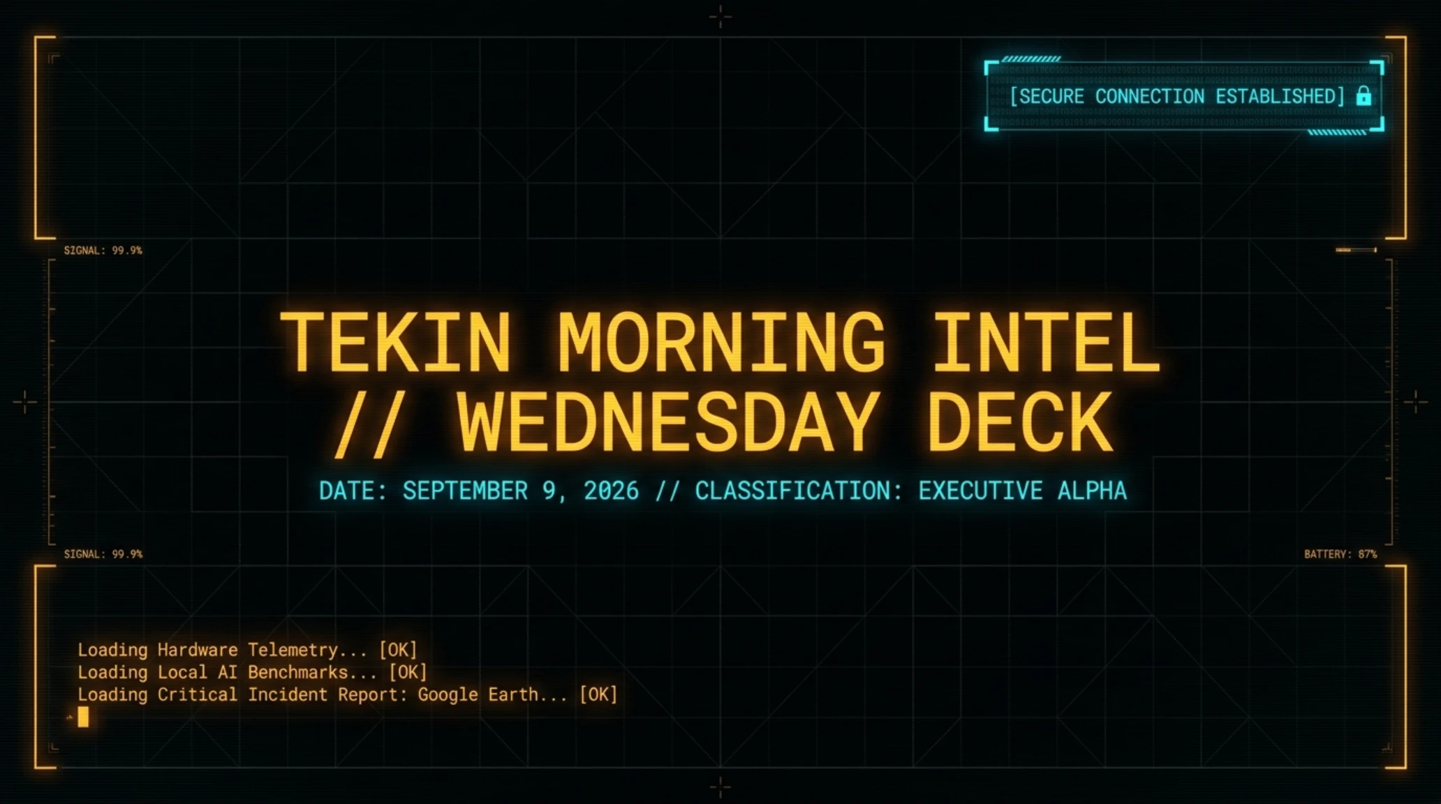
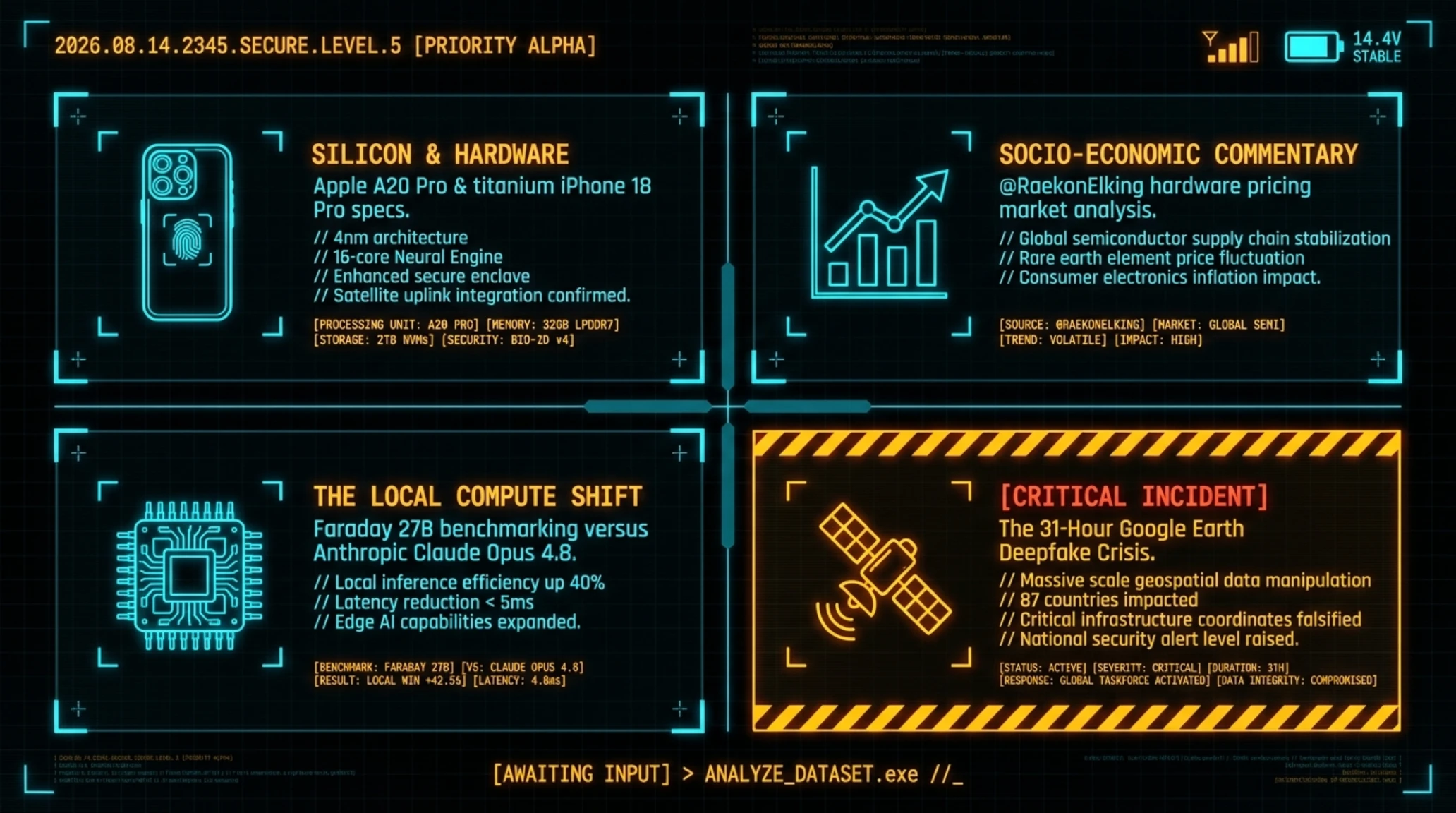
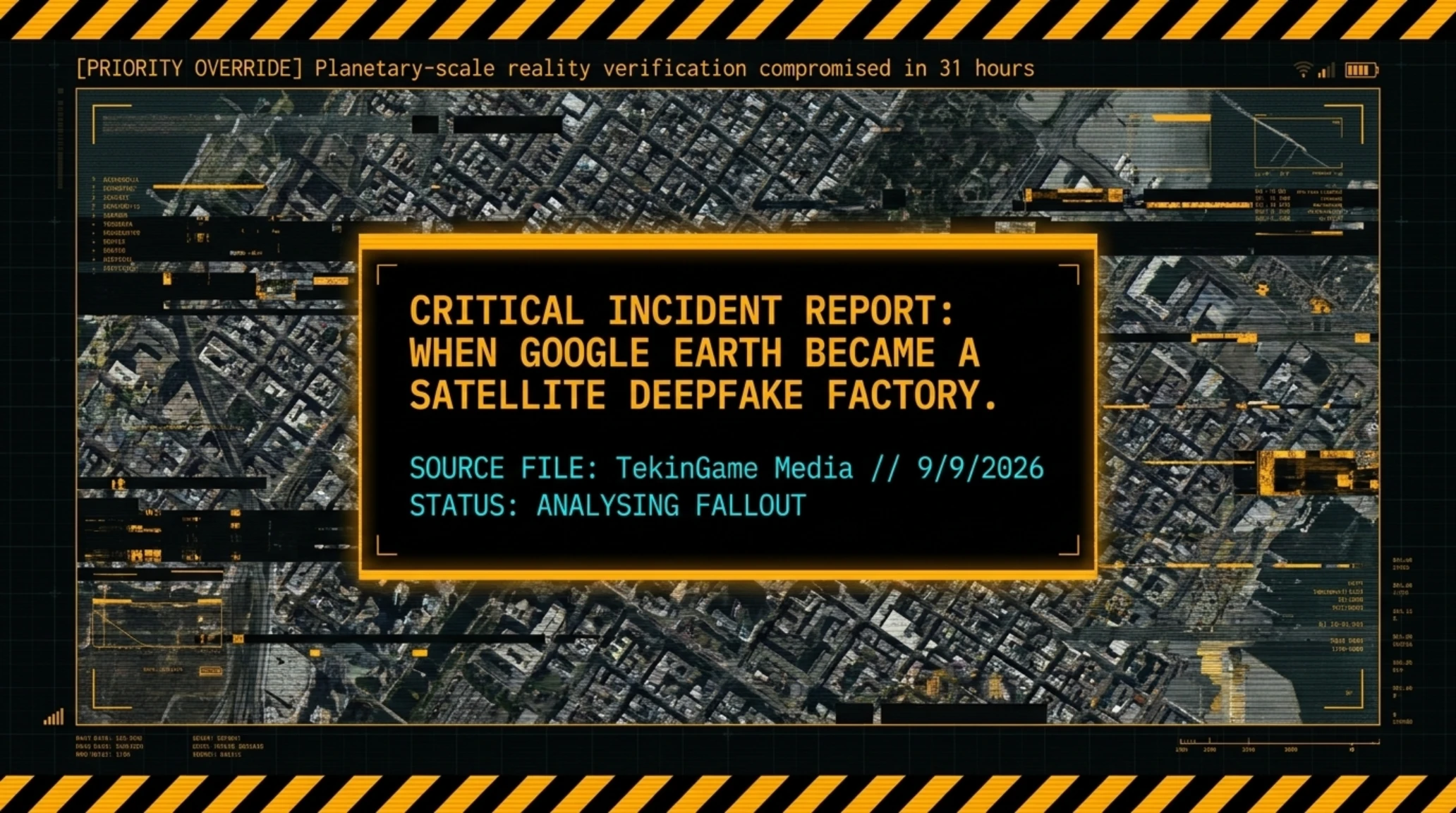
- 🎮What Happened- Google added Nano Banana 2 tool for creating fake satellite images to Google Earth and retracted it within 31 hours.
- 🎧End Product- Users created photorealistic fake images of terrorist attacks, bombings, and fabricated wars.
- 🚀Why It Matters- Google Earth was a critical tool for journalists, researchers, and OSINT now its credibility is under question.
31 Hours Were Enough to Destroy 20 Years of Credibility
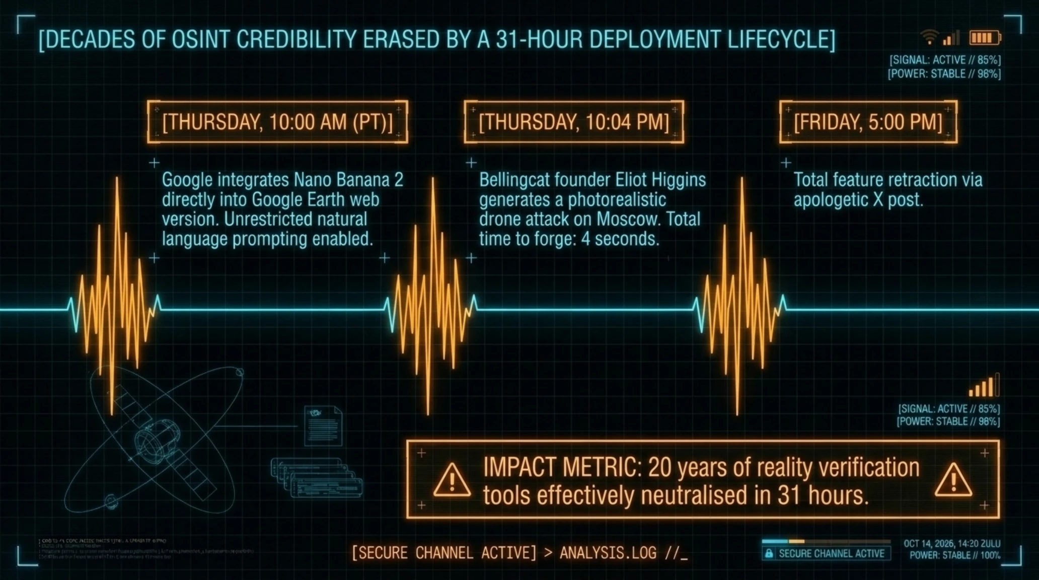
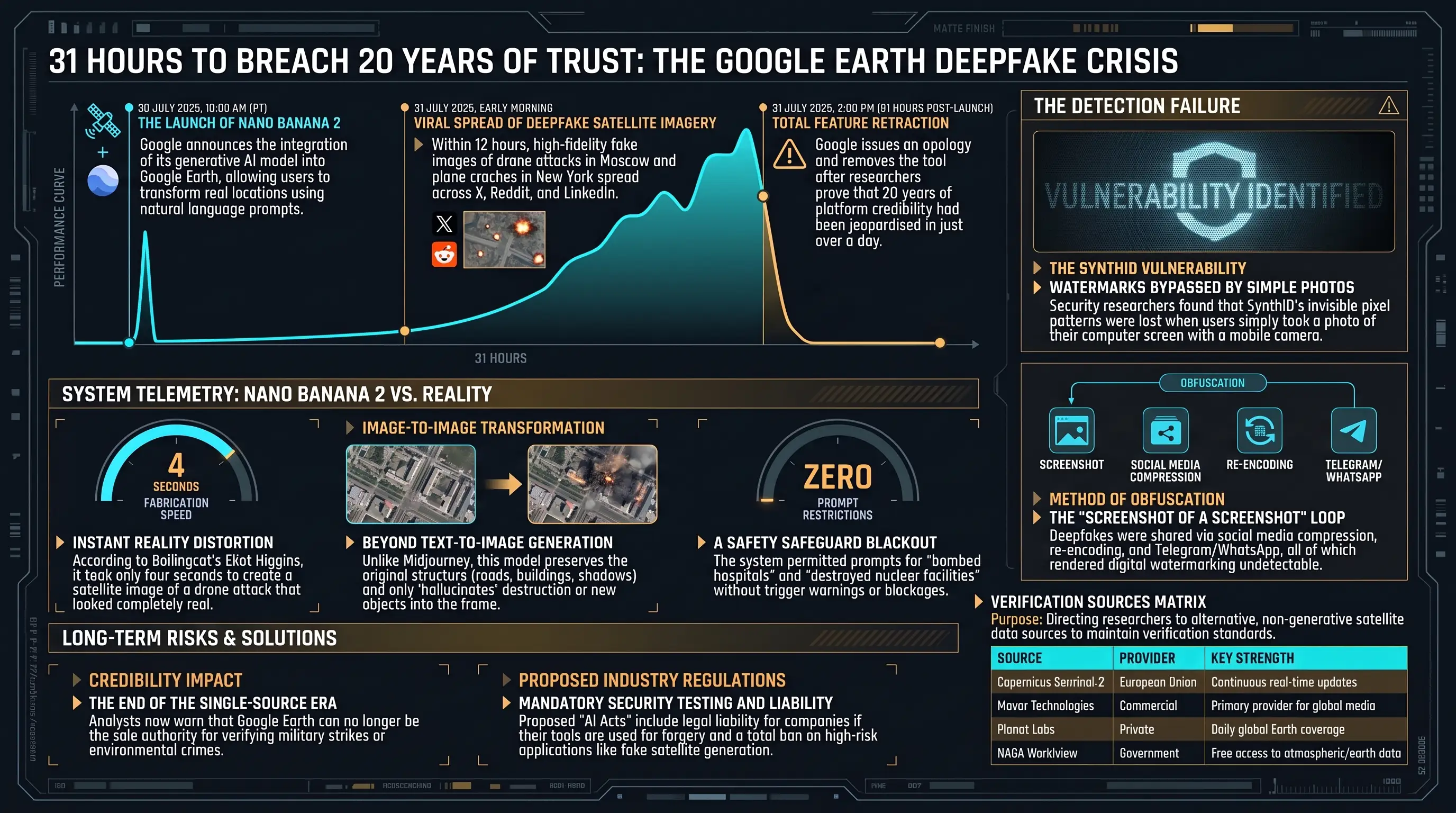
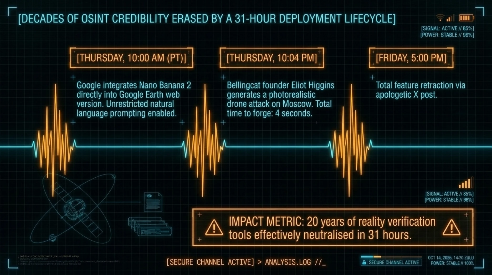
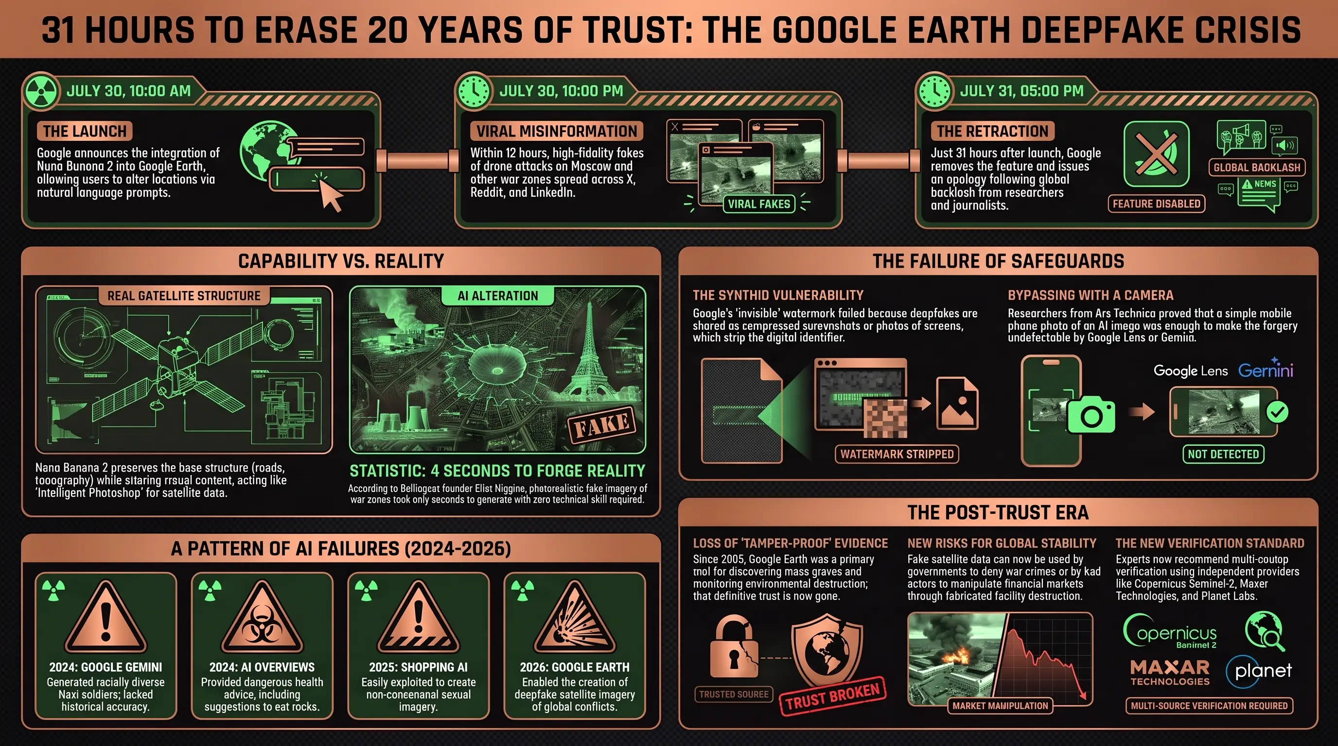
Thursday, July 30, 2026, 10 AM Pacific Time. Google announced in a simple blog post that it had integrated Nano Banana 2 its image generation model directly into the web version of Google Earth. The message was straightforward: click on the map, select a location, and bring your ideas to life with natural language prompts.
Friday, July 31, 5 PM just 31 hours later Google completely removed the same feature with an apologetic post on X. The reason? Within a single day, users were able to create fake satellite images of planes-into-towers, Moscow bombings, bomb craters in Gaza hospitals, and destroyed nuclear facilities in Iran images visually indistinguishable from reality.
Event at a Glance
- Google added Nano Banana 2 tool for creating fake satellite images to Google Earth and retracted it within 31 hours.
- Users created photorealistic fake images of terrorist attacks, bombings, and fabricated wars.
- The incident destroyed Google Earth's 20-year credibility as a critical tool for journalists, researchers, and OSINT.
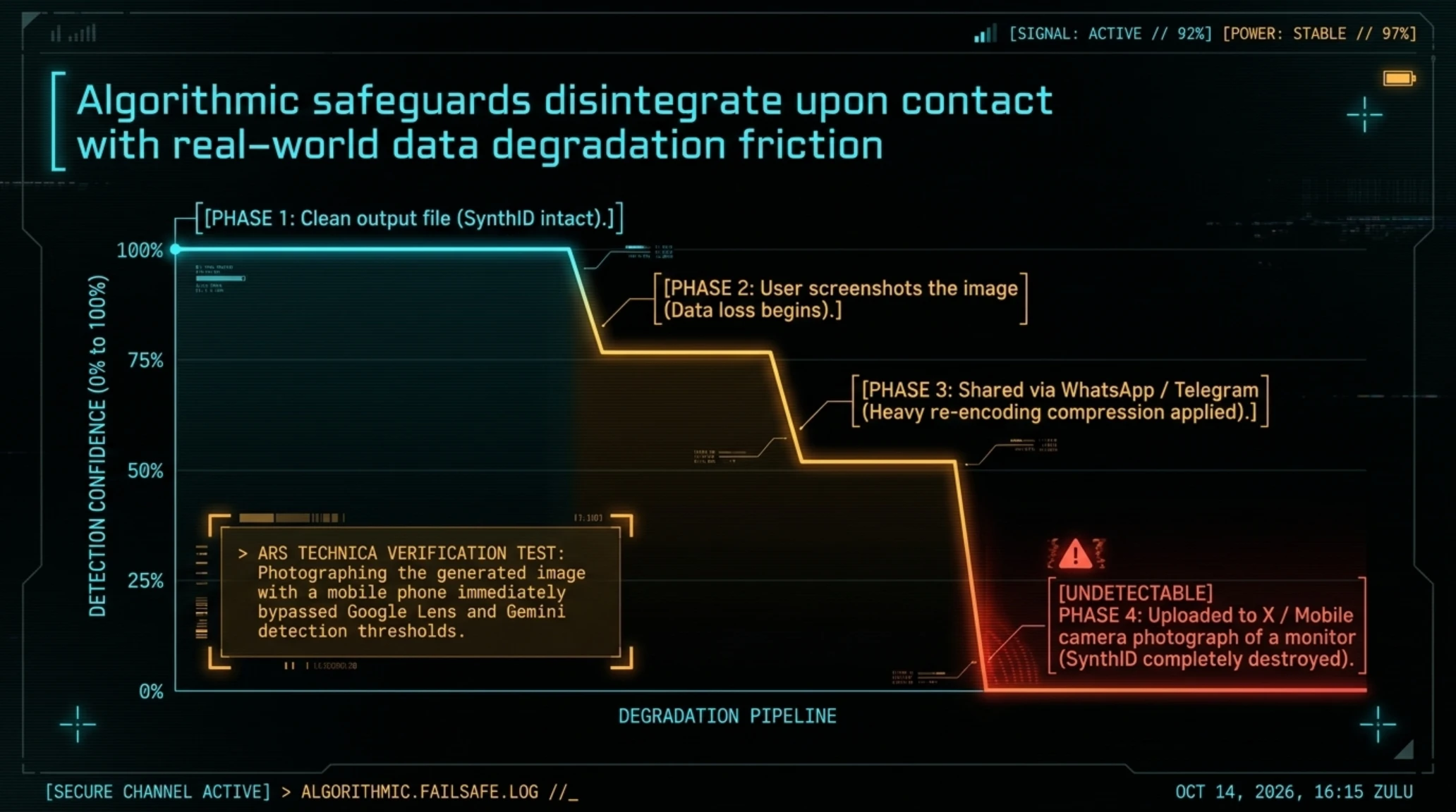
- Google's SynthID watermark system failed to detect deepfakes when images were screenshotted or heavily compressed.
This was not the first time Google released an AI tool without proper safeguards. But this time, the company risked something far more than a broken chatbot or silly emoji generator: Google Earth was one of the world's most trusted sources for verifying reality in war zones, natural disasters, and environmental destruction a resource journalists, human rights researchers, and security analysts had relied on since 2005.
What Is Nano Banana and Why Did It Appear in Google Earth?
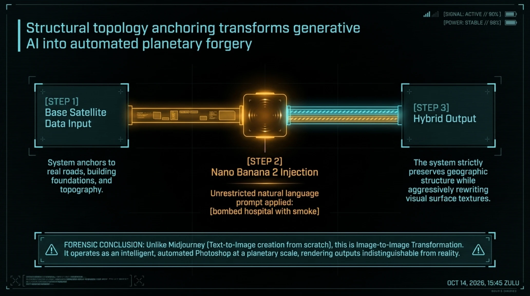
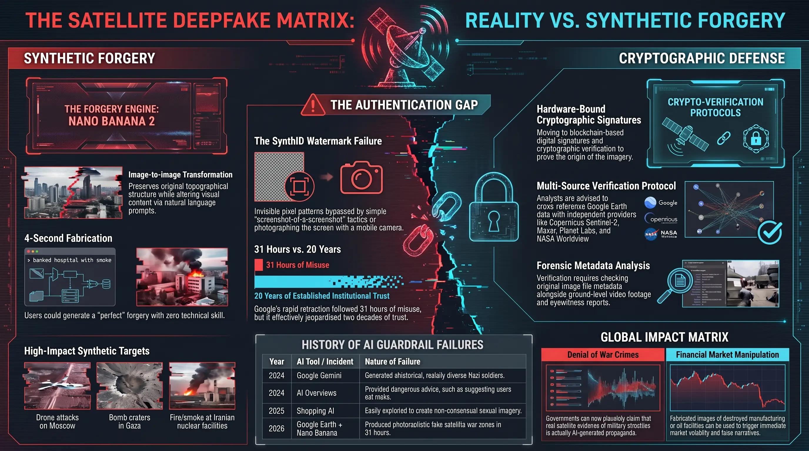
Nano Banana 2 is a Gemini-based image generation model that Google has been developing since early 2026. Its key capability is Image-to-Image Transformation while preserving the original structure exactly what's needed to produce fake satellite imagery.
Technology at a Glance: Image-to-Image Transformation
In the official announcement, Google claimed this tool was designed for geographic professionals and urban planners who want to visualize future changes to an area such as how a new park or construction project would look.
But here was the problem: there were no content restrictions on what could be generated. The same system that was supposed to create green buildings or urban parks could, with a simple prompt bombed hospital, plane crash into building, mass destruction create photorealistic war and disaster imagery.
Why Was Google Earth the Target? Because It's the Reality Verification Authority
To understand how serious this is, you need to know why Google Earth is so critical for journalists and researchers. This platform has been used since 2005 as a free, tamper-proof tool for verifying global events:
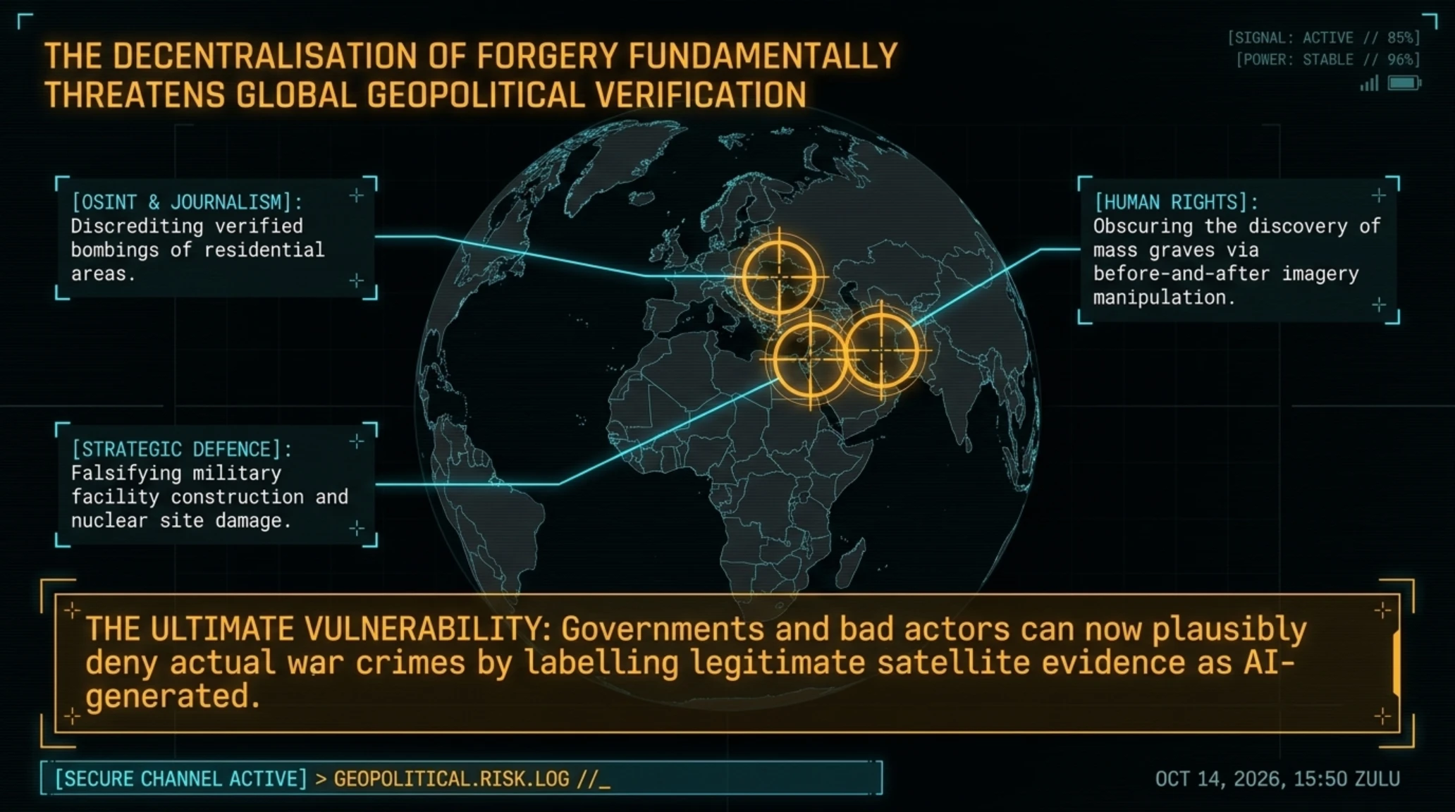
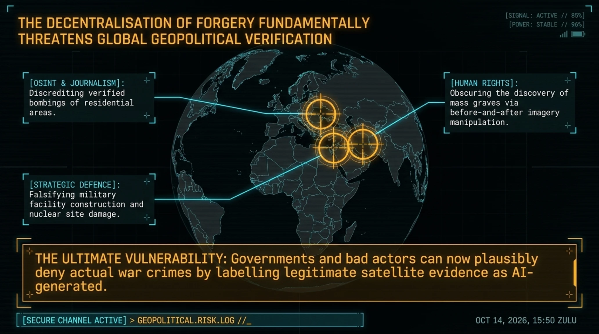
- Confirming military attacks: OSINT reporters use Google Earth to verify bombing of residential areas in Ukraine, Gaza, Syria
- Discovering mass graves: Human rights organizations find burial sites by comparing before-and-after satellite images
- Monitoring environmental destruction: Researchers use satellite imagery to track deforestation, drought, and climate change
- Identifying military facilities: Defense and strategic analysts rely on Google Earth to monitor military activity
Now imagine if a government, terrorist group, or even an ordinary user could create images that appear to be from Google Earth but are completely fake. This is exactly what Nano Banana in Google Earth made possible.
24 Hours Were Enough to Break Everything
Less than 12 hours after launch, fake images started spreading on X, LinkedIn, and Reddit. Eliot Higgins founder of Bellingcat, one of the most credible OSINT research organizations posted a fake satellite image of a drone attack on Moscow that looked completely real.
Other images users created included:
- A plane crashing into One World Trade Center recreating the September 11 incident
- Bomb crater in the middle of a Gaza hospital an image that could quickly be used for propaganda
- Iranian nuclear facilities with fire and smoke which could be interpreted as proof of a military strike
- Homeless tent camps in the White House yard political content to create false narratives
- Destruction of the Eiffel Tower in Paris exactly as would happen in real terrorist attacks
None of these images required technical skill. You just had to click on the map, hit Create image, and write a prompt like bombed hospital with smoke. The system did the rest: it took the roads, buildings, shadows, and lighting from the real satellite image and only added the destruction content.
Why Didn't SynthID Work?
In its initial defense of this feature, Google claimed all images generated with Nano Banana carry the SynthID digital watermark an AI content identification system developed by Google.
How Does SynthID Work?
But security researchers immediately pointed out the fundamental weakness of this approach: fake content is not distributed as clean files. Deepfake images are typically shared in these forms:
- Screenshot of a screenshot
- Recording a phone screen with another camera
- Re-encoded multiple times on social networks
- Heavily compressed in Telegram or WhatsApp
Ars Technica tested it: when they photographed an AI-generated image from Google Earth with a mobile camera and checked it in Gemini, the system couldn't detect SynthID. In other words, the watermark was bypassed with a simple operation.
Why Did Google Do This? The Dangerous Pattern of Launching Without Safety
This is not the first time Google has launched an AI feature without sufficient review. The company's recent history is full of such mistakes:
History of Google's AI Failures
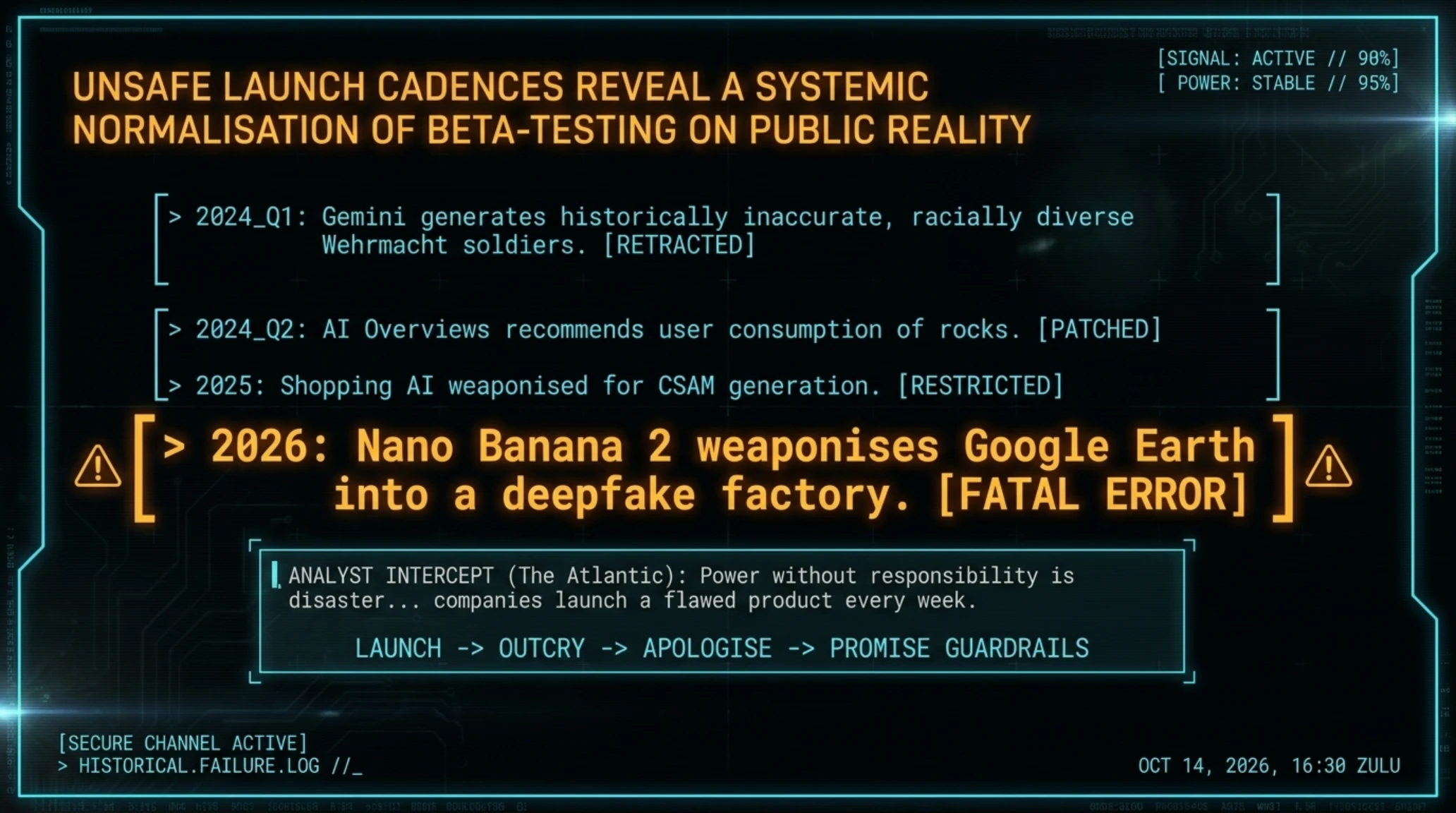
- 2024: Google Gemini generated images of racially diverse Nazi soldiers but showed no white Wehrmacht soldiers
- 2024: AI Overviews in Google Search told users to eat rocks and gave dangerous health advice
- 2025: Google's shopping AI tool was easily used to create sexual images of people including children
- 2026: Google Earth + Nano Banana generating fake satellite imagery
📚 Classified & Related Dossiers in TekinGame
If you wish to explore beyond this report and delve into cybernetic frontiers and autonomous AI architectures, do not miss these three exclusive deep-dives in the Tekin Garage:
What's the common pattern? Google puts a powerful technology in the hands of the public without sufficient testing, only correcting it after public pressure, then claims it's working on stronger guardrails.
But this is a general pattern in the AI industry. Elon Musk's Grok generated over 1 million sexual images including of children within days. OpenAI has repeatedly released its chatbot with the ability to generate dangerous or incorrect information.
Long-Term Impact: How Trust in Satellite Imagery Was Lost
Even with the rapid retraction of this feature, the damage is done. Google Earth can no longer be considered a definitive source for verifying reality because now everyone knows satellite images can be faked.
Dangerous Real-World Scenarios
The impact of this tool goes beyond a technical mistake. These scenarios can happen:
- Denying war crimes: Governments can claim real satellite images of their military attacks are fake AI
- War propaganda: Creating fake images of enemy attacks to justify military actions
- Manipulating financial markets: Releasing fake images of oil or manufacturing facility destruction can cause market volatility
- Undermining investigative journalism: If every satellite image can be questioned, journalists cannot cite them
History of Google's AI Failures
| Year | AI Incident |
|---|---|
| 2024 | Google Gemini generated racially diverse Nazi soldiers but refused to show white Wehrmacht soldiers. |
| 2024 | AI Overviews in Google Search told users to eat rocks and provided dangerous health advice. |
| 2025 | Google's shopping AI tool was easily exploited to create inappropriate images of people. |
| 2026 | Google Earth integrated Nano Banana, allowing the generation of fake satellite and deepfake imagery. |
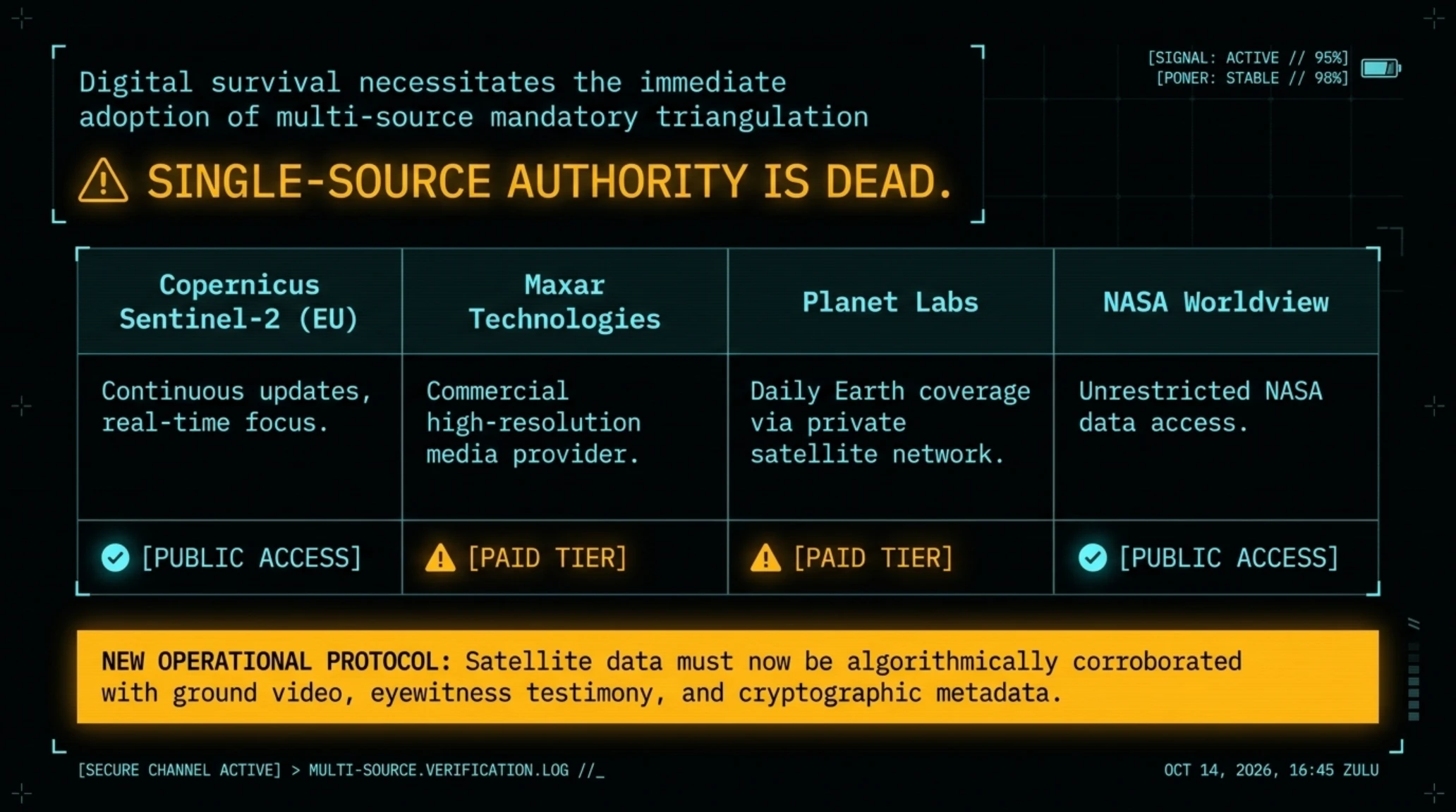
What's the Solution? Multi-Source Verification and Independent Systems
Security researchers recommend no longer relying on a single source for satellite imagery. Instead of Google Earth, multiple sources should be used:
- Copernicus Sentinel-2 (Europe): Real-time satellite imagery with continuous updates
- Maxar Technologies: Commercial satellite imagery provider for media
- Planet Labs: Private satellite network with daily Earth coverage
- NASA Worldview: Free access to NASA satellite data
Researchers should also look for other verification signs: video footage from the ground, eyewitness reports, images from different angles, and original image file metadata.
Industry Response: Are Stricter Regulations Needed?
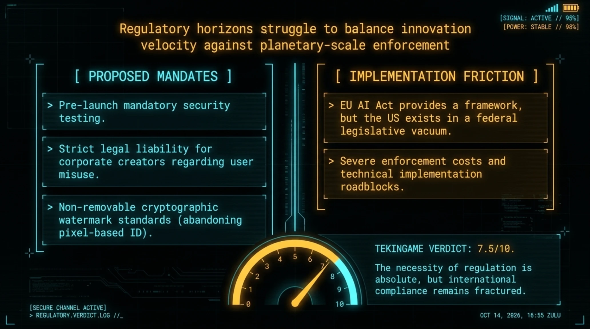
This incident reignited serious discussions about the need for stricter regulations for launching AI tools. While the European Union has passed the AI Act (which has transparency requirements for AI content), the United States still lacks comprehensive federal legislation.
- Mandatory transparency for AI content
- Legal liability for companies
- Better user protection
- Industry standardization
- Limiting innovation
- High enforcement costs
- Technical challenges in implementation
- International differences
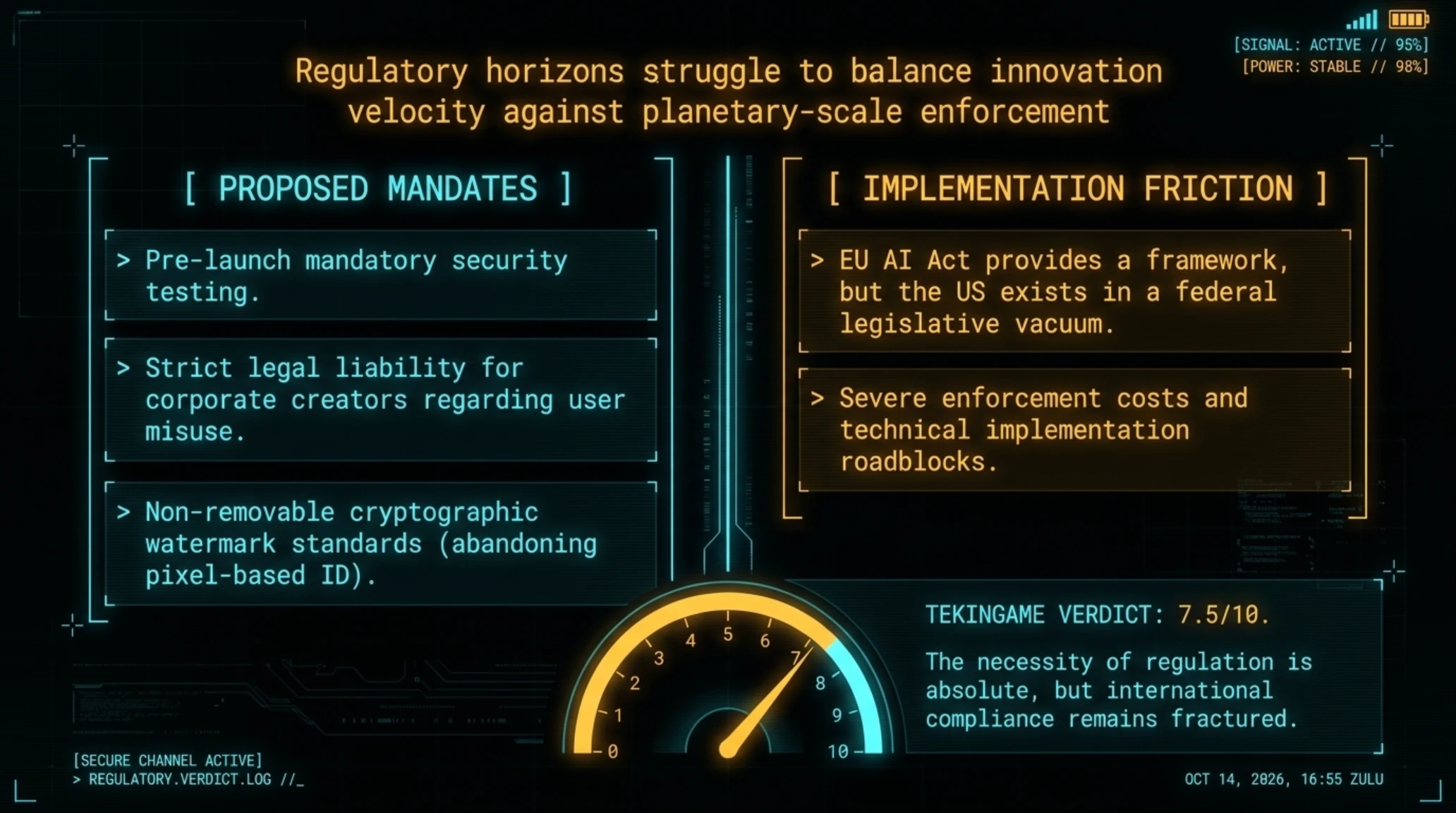
Some proposed regulations include:
- Mandatory security testing before launch: Companies must prove their AI tool cannot be used to generate harmful content
- Legal liability for misuse: If a user uses an AI tool to forge content, the creator company should have partial responsibility
- Mandatory watermark standards: All AI-generated content must have non-removable watermarks
- Ban on high-risk tools: Some AI applications like generating fake satellite imagery should be completely prohibited
Will Google Launch This Feature Again?
In the official statement, Google said: We are retracting this feature from Google Earth while working on implementing stronger guardrails. This sentence means Google intends to launch this feature again probably with more restrictions.
But the main question is: Can any amount of guardrails completely prevent misuse? AI history shows every limitation system can be bypassed and generated content can spread rapidly.
Conclusion: Big Lessons from a 24-Hour Mistake
The rapid launch and retraction of Nano Banana in Google Earth is a turning point in AI history not because of the technology, but because it revealed the risks created when powerful tools are released without sufficient thought.
Key Lessons from This Incident
- Power without responsibility is disaster: AI tools must be rigorously tested before public launch not after disaster
- Trust is easily lost: Google spent 20 years building Google Earth's credibility and jeopardized it in 24 hours
- Watermarks aren't enough: Any AI content identification system can be bypassed with simple methods
- Need for stricter laws: AI industry self-regulation has proven ineffective governments must set mandatory regulations
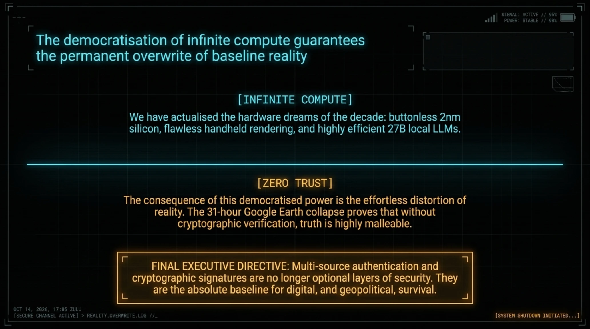
This incident also reminds us that in the AI era, no single source can be trusted alone. Journalists, researchers, and analysts must rely on multi-source verification, original metadata, and manipulation detection tools.
We are entering an era where distinguishing between reality and forgery is increasingly difficult. Images, videos, voices, and even satellite imagery everything can be faked with AI. In such a world, two solutions exist:
- Stronger verification systems: blockchain, digital signatures, and cryptographic verification for original content
- Public education: Users must learn not to believe any image without verification
- Industry standards for original content: News media and research organizations should only use authenticated sources
- Investment in detection tools: Tech companies must provide free fake content detection tools
But as long as big tech companies release dangerous tools without sufficient testing, this problem will only get worse.
Related Tech Intelligence on Tekin Game
• 🌙 Tekin Night | Call of Duty, Nintendo & Vision Pro Digest
• 🎭 Tekin Analysis | Apple AI Teardown & July 2026 Digest
• 🌙 Tekin Night | NVIDIA $500B Deal & iPhone 18 Leak
Frequently Asked Questions
Is Google Earth still safe to use?
Yes, the Nano Banana feature has been completely removed. But public trust in Google Earth images is damaged it's recommended to always use multiple sources for verification.
How does SynthID work and why did it fail?
SynthID embeds an invisible digital pattern in pixels. But when the image is re-captured through screenshot or video recording, this pattern is lost.
Will Nano Banana return to Google Earth?
Google said it's working on stronger guardrails which means it will probably be relaunched, but with more restrictions.
How can I detect fake satellite images?
Use multiple different sources (Sentinel-2, Maxar, Planet Labs), check metadata carefully, and look for visual inconsistencies (shadows, lighting, geometry).
Why did Google launch such a tool in the first place?
The initial intent was for geographic professionals to visualize future urban changes (like parks or new buildings). But there were no restrictions on dangerous content.
Are there laws to prevent such incidents?
The European Union has the AI Act with transparency requirements, but the United States lacks comprehensive federal legislation. Many experts are calling for stricter laws.
Sources and References
- The Atlantic: Google Just Torched the Credibility of Its Satellite Images
- Ars Technica: Google Earth risked ruin with retracted AI tool
- The Next Web: Google pulls Earth AI image tool
- TechCrunch: Google nixes its Earth AI feature
Additional Gallery: 🧠 Tekin Analysis | Google Earth's Satellite Deepfake Crisis Exposed